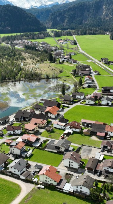
Musau
The village is located on the left bank of the Lech River, only six kilometers northwest of the district capital Reutte. Musau is a scattered settlement whose districts Rosschläg, Brandstatt, Höllmühle, Saba, Leite, Hofstatt, Riedle and Platte are spread over a length of about 4 kilometers.
- Sea level: 821 m
- Inhabitants: 385
- Total Area: 20,66 km²
- Population density: 19/km²
- Districts: Platte, Riedle, Hofstatt, Leite, Saba, Brandstatt, Höllmühle, Rosschläg
The first documentary mention of the village is found in 1218, but its history dates back to the 9th century. At that time Musau was connected with the monastery of St. Mang in Füssen (D), also the monastery of Stams in Tyrol owned land here. Later, Vils exercised jurisdiction. On the road from Musau to Vils, the lords of Hohenegg, who ruled there, operated a road customs office.
A bridge over the Lech River is mentioned as early as the 16th century; the Ulrichsbrücke, built of concrete in 1914, is used today as a bicycle path; a newer bridge now serves road traffic instead. In 1816 Musau then became part of Tyrol.
Until after the Second World War, agriculture, especially animal husbandry, was the main occupation of the villagers. However, it could not cover the livelihood, so that, as in all areas of the Außerfern, some of the men and children (Swabian children!) were forced to earn a few extra kreuzer for their living as guest workers abroad during the summer. With the emerging industrialization in the 19th century, jobs were created in Reutte and in the neighboring Allgäu, which also benefited the Musau population.
In Musau, old customs are still lived - in our blog you can learn more about the custom of the Bareigang.
The location close to the border and the good road connections to Inner Tyrol are an ideal prerequisite for excursions. Musau is also an ideal starting point for beautiful hikes to huts and alpine pastures.


